Graham Creek (Juvenile Monitoring)
Clatskanie River Population
Graham Creek
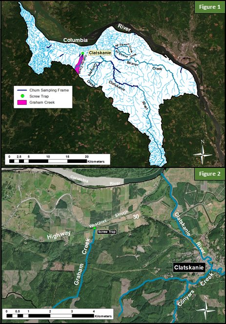
Graham Creek flows into Westport Slough approximately 3 miles west of the town of Clatskanie, OR (Figure 1). No estimate of historical abundance of Chum Salmon is available for this creek and no Chum Salmon have been observed in the creek in the last 20 years. The lower portion of the creek has been straightened and land use is agricultural. Above Colvin Road, the creek runs through a forest with timber operations. Habitat surveys in 2012 and 2013 identified suitable gravel and upwelling groundwater, although the simplified channel has little pool structure, cover, or large woody debris (Alfonse et al. 2017a). In 2014, both a fence panel and incline plane trap were installed immediately downstream of Hwy 30 and approximately0.1 Rkm upstream of Westport Slough (Figure 2 ). The traps were installed on February 2 7th and removed on June 15th. However, due to the inefficiency of operating the incline plane trap within tidal reach, the fence panel trap was fished exclusively for most of the season.
Literature
Alfonse, B., K. Homel, J. E. Nunnally, and E. Suring. 2017a. Chum Salmon Spawning Habitat Report for the Clatskanie River and Scappoose Creek Populations. Oregon Department of Fish and Wildlife. Clackamas, Oregon. 196 pages.